This region is bursting with activities and scenery that is absolutely stunning. Do not underestimate how long it will take you to explore this wonderful peninsula.
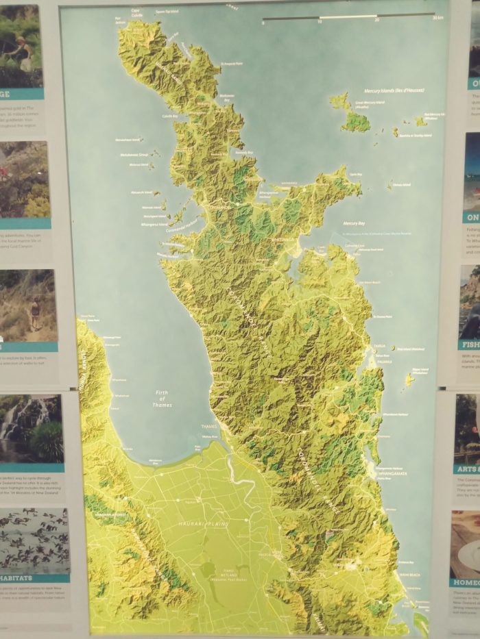
You can work your way around either way, starting at Thames and going up and around the western side, or starting in Waihi and finishing at Thames going around the eastern side first.
A clear view of how the journey north starts at Thames up to Tapu a sleepy coastal village
For those going further north to Coromandel Township or Papa Aroha, here is the full road trip video.
Road trip from Thames to Papa Aroha
There are plenty of worthwhile side trips off the main road and as of July 2019 we are just starting to explore this region. Over three nights we started in Thames and drove along the coast road north to Coromandel Town for our first night. Often you look at a map and it shows the highway hugging the coast and when you actually drive it, the coast is hundreds of meters away hidden from view. Well, not this road, it literally hugs the shore line and you can’t take your eyes off the road or you will end up in the sea. Just a tip, don’t drive north, late in the afternoon as the sun will be low and in your direct vision making it difficult to see.
There are beautiful sandy beaches scattered along the road side. Parking at many is very limited, but there are also plenty of larger parking areas. You’ll see the locals out casting their fishing lines from the rocks and the road has many cars and boat trailers rushing to or from their favourite spots.
One of the main attractions to the southern region of Coromandel is the Hauraki Rail Trail. This is a multi directional trail that follows the old railway line. Many start in Thames where there is plenty of parking close to the start. From Thames riders head south towards Paeroa or west towards Miranda., The the trail splits around each side of the Kaimai Ranges at Paeroa. The western side goes to TeAroha and Waihi, whilst the eastern side to Waihi. The Waihi side includes the very popular Karangahake Gorge which includes tunnels and river bridges. I have much more on the gorge elsewhere on this site, just click on the link. Bay of Plenty
We have ridden most of the different parts of the trail which mostly cuts through dairy farmland. Beware of riding late in the afternoon as millions of small flies start to appear and are easily breathed in and swallowed. There are plenty of cafes and specialist shops to explore along the journey.
So lets start this exploration of the Coromandel region by heading north from Coromandel Town. This road heads to the northern most tip of the Coromandel Peninsula. There is no road connection right around the northern tip. You can walk along a track that connects the two road ends and there are shuttle companies that will drop you off at one end and collect you at the other. Personally, I’d hate that drive each day. The roads are narrow, twisty, steep and mostly unsealed. For the visitors though, you will be greeted with some spectacular views.
Before you leave the small village of Coromandel head west out of the town and visit this beautiful bay. It’s just a short drive and there is a popular camp ground at the end of this road.
A short view of the start of the road north. It is suitable for all size vehicles but can be very narrow and single lane in places. A stunning drive with sea, bush and beach views.
Watch at 2 mins 54 seconds at how quickly oncoming traffic appears.
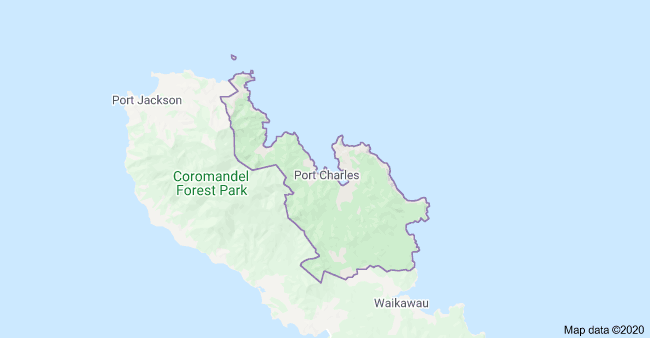
The road north from Coromandel Town is sealed and quite suitable for all vehicles. There are some steep grades and tight turns, but quite safe and manageable. Just north of Colville you turn left to get to Port Jackson and Fletcher Bay.
The road from Coromandel directly towards Kennedy Bay is so steep in places that parts of it are sealed. This short video shows how steep, tight and twisty the road is. This video is coming back from Kennedy Bay.
As you head back towards Coromandel Town you can decide to explore the north eastern side of the peninsula. From where the roads splits north of Colville and you have turned left to go to Fletcher Bay you can now go the other way and checkout Port Charles and Stony Bay. This is where this side of the Peninsula is joined by a walking/cycle trail that connects to Fletcher Bay. There is a large DOC campsite here.
Another tight twisting unsealed road.
There are some beautiful beaches east of Coromandel accessed by narrow gravel roads. You can drive north through Colville or East past Driving Creek to Kennedy Bay, then North to Stony Bay the furthermost accessible by road on the north eastern side. The roads are very narrow, one lane in many places with mostly bush views. The beaches are well worth visiting but only for confident drivers in my opinion. I know people take large motorhomes and caravans in but there are many blind corners, steep grades and narrow bridges. If two large vehicles met in some places there would be some serious backing up and manoeuvring to do.
So now that we have checked out the western side of the Coromandel Peninsula it’s time to head over the hill to the eastern side, which is more populated, less remote and much more frequented. Most of the roads this side are sealed but there are still plenty of steep twisting sections. In winter check for road closures due to slips and crashes and in summer add 20 to 30 minutes travel time due to the huge volumes of traffic. I have included two sections on accessing the eastern side, one from Kopu near Thames and one from Coromandel Town.
One of the main access roads to the Eastern Coromandel is via Kopu near Thames. The road heads east towards Whitianga and Whangamata the largest towns but there are myriads of smaller towns with amazing beaches and rivers to explore and enjoy. Due to the popularity of the region, especially by New Zealanders, the roads get very congested which is exasperated by the tight corners and steep ascents and descents. The following video shows the first section almost to the first major intersection. This will show you a small taste of what you will experience driving around the peninsula.
The road from Kopu, near Thames towards Hikuai
Accessing the Eastern side of the Coromandel from Waihi to Whangamata
The road from Coromandel Town on the Western side to Whitianga on the Eastern side is steep and windy. Here’s a video of the road.
This is one of the steepest roads in the region, but is sealed and well made.
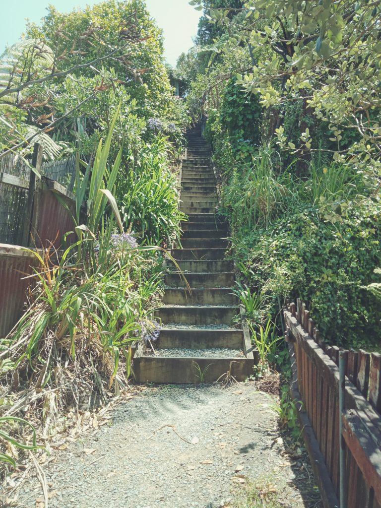
Along the East Coast of the Coromandel are a number of gorgeous beaches and rivers along with the major tourist attractions. However you don’t need to spend heaps of money to have fun and explore. One of our favourite places is Tairua, a very small seaside village that packs a punch with walking tracks, beaches, marina, cafe’s and restaurants. The surf beach offers safe swimming as does the harbour which is very tidal. The tall hill, Mt Paku, at the head of the harbour has a great walking track that takes you to the summit where there are some awesome 360 views over Tairua, the harbour and Pauanui. To access the walkway you can choose to start right down by the waters edge just by the Marina, or start halfway up from the large car-park on Paku Drive. Just walk from the car-park up the grassy field towards a small sign and basically keeping going straight up.
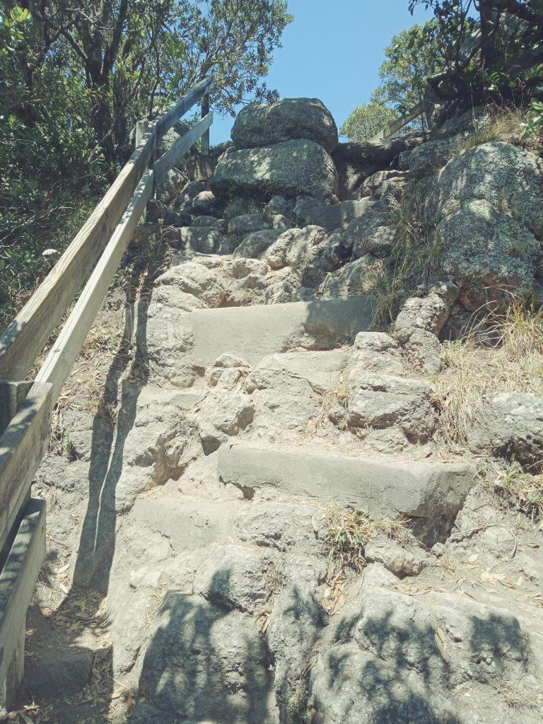
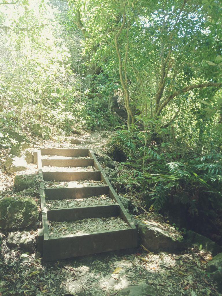
Here are some photos of the track and views. This track requires a good level of fitness, there are some rocky sections but also plenty of formed tracks and steps.
Last section before the summit
Some of the formed steps you will see on the way up
This section is encountered going up from the seaside, you won’t experience this starting from the car park.
As you work your way around the Coromandel Peninsula you find many side roads pointing towards Beaches and Bays. They are well worth checking out, but some of the roads are very steep, twisty and unsealed. Over the hill from Coromandel towards Whitianga is a seaside village and a beautiful beach, called Matarangi . There is a space set aside for freedom camping close to the boat ramp. This is a developing area with modern holidays homes and a small shopping centre. The pure white sandy beaches that we see remind me of tropical islands. Our journey is in late winter so in summer will be much more appealing.
Between Matarangi and Whitianga is a small peninsula that has a few lovely beaches and is again a developing area with many substantial holiday homes being built. The road in leaves a lot to be desired as again, as is typical of the Coromandel “off the beaten track” beaches and bays the roads are shocking. Tight, narrow, steep and twisty and mostly unsealed. However, if you want to see how the locals live and get away from the busy main tourist spots, then this is where to go.
This is the most eastern point of the Coromandel. An interesting place to explore.
There are three main beaches, the first you come too is Otama. This is a long sandy beach.
Otama Beach .
Opito Bay, Eastern Coromandel
Matapaua Bay. The road into here is definitely not for the feint hearted. Beautiful beach but very limited parking. Very steep dangerous road in.
Whitianga is a very modern town and appears to be growing quickly. It has just about everything you would need with a large shopping area, boat trips to all the major tourist destinations and a ferry ride across the estuary to Cooks beach, another very popular holiday destination for Kiwi’s. I’ll have more on this below.
There is a very long white sandy beach with plenty of parking and just a few minutes walk to the town centre. It is growing rapidly and there are extensive canal homes of considerable value.
Moving further south and just over the estuary from Whitianga is Cooks Beach. This is another beachside resort with beautiful white sandy beaches and a river estuary with crystal clear water. Just above Ferry Landing which is directly opposite the town centre of Whitianga is a park with views over both Whitianga and Cooks Beach. From Cooks Beach you can easily drive to Hahei, Cathedral Cove and Hot Water Beach. Here are some video clips to whet your appetite to want to explore this region. During the peak summer months of December and January the numbers quadrupedal so book ahead for accommodation and be prepared for large crowds.
Cooks Beach from Shakespeare Cliff Reserve
View from Shakespeare Cliff Reserve of Cooks Beach around to Whitianga
Driving around from Cooks Beach towards Hahei, then down a side road you reach a private reserve with public access. This is directly opposite Cooks Beach and Purangi Reserve
Cathedral Cove Viewing Platform. Parking is extremely limited , just a drop off and pickup point. Access to the walking track to the cove starts here.. The DOC sign says 40 minutes walk, one way. Not sure if that means down or up!
Hahei Beach is just a bit further down the road, another lovely white sandy beach. This is just up the bays from Hot Water Beach.
Tips for exploring Whitianga, Cooks Beach and Hot Water Beach. In summer and peak tourist season it is very busy, parking will be very limited and freedom camping sites will fill up quickly. You will be fined for breaking the regions freedom camping rules and you can be asked for written certification of your self containment. Shopping in Cooks Beach and Hahei is limited, just across the estuary is Whitianga with fuel and large supermarkets. The ferry is $7 return (as at Aug 2019). The roads are narrow and very steep in places, but quite manageable for most vehicles. Cycling on these roads is very dangerous because there is no berm, tight blind corners and vehicles that travel way faster than the conditions allow. Take care, stay within the white lines, always and keep left!
Just down the road further south on the main road is Tairua, another seaside village offering more white sandy beaches and elaborate holiday homes. Just over the harbour is Pauanui which is accessed by driving further south before you turn back north again, approx a 20-30 minute drive. Pauanui is a small seaside village full of holiday homes and more white sandy beaches. There are some short walks at South End Beach Reserve.
Pauanui is creating an off-road cycle track that will eventually make it possible to cycle between Taiirua and Pauanui. At present (Aug 2019) it is only 4 klm’s long.
Pauanui is a holiday destination for wealthy kiwis who have expansive holiday homes on canal homes. It is a very tidy upmarket seaside town with a great white sand beach with great fishing, some short bush and coastal walks from the south end of the beach. You will often see people fishing from the rocks just along the base of the large hill on the south end of the beach. There is also a walk up to the trig station which we haven’t done as the weather was against us. (Aug 2019). We will be back to explore more of this place.
Pauanui Beach from the south end.
The next accessible beach by road as you head south is Opoutere Beach. This is accessed via a sealed road that arrives at a gravel car-park and approx 800 meter walk through a forest track to a very long white sandy beach. There are a few holiday homes alongside a very large estuary and a public toilet and not mush else. This area would be heaven for bird watchers and beach lovers.I would imagine that the surf would get up with easterly winds.
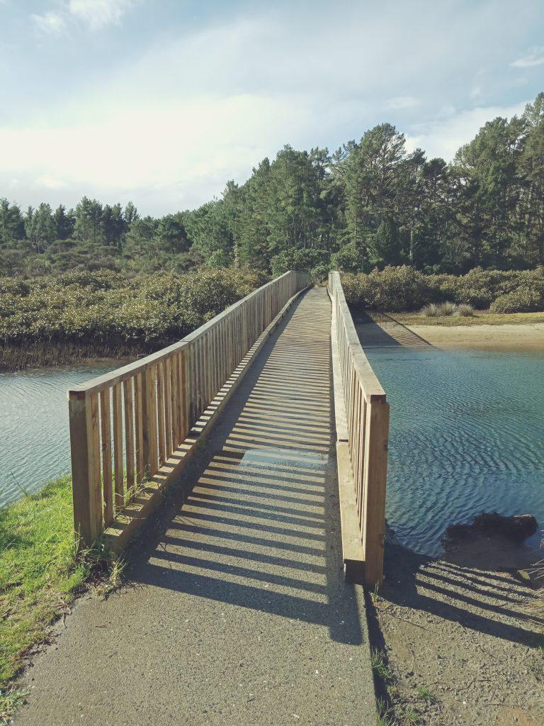
The start of the walking track that takes you to the beach. It is a level and easy walk down to the beach of around 800 metres.
As you head further south, the next side road takes you to Onemana Beach. This beach is more built up with expansive holiday homes, a shop and restaurant, tennis courts and a wonderful kids playground. There are walking tracks up the hill at the southern end of the beach. The track is very steep and is not formed so good footwear is requires, especially in winter.
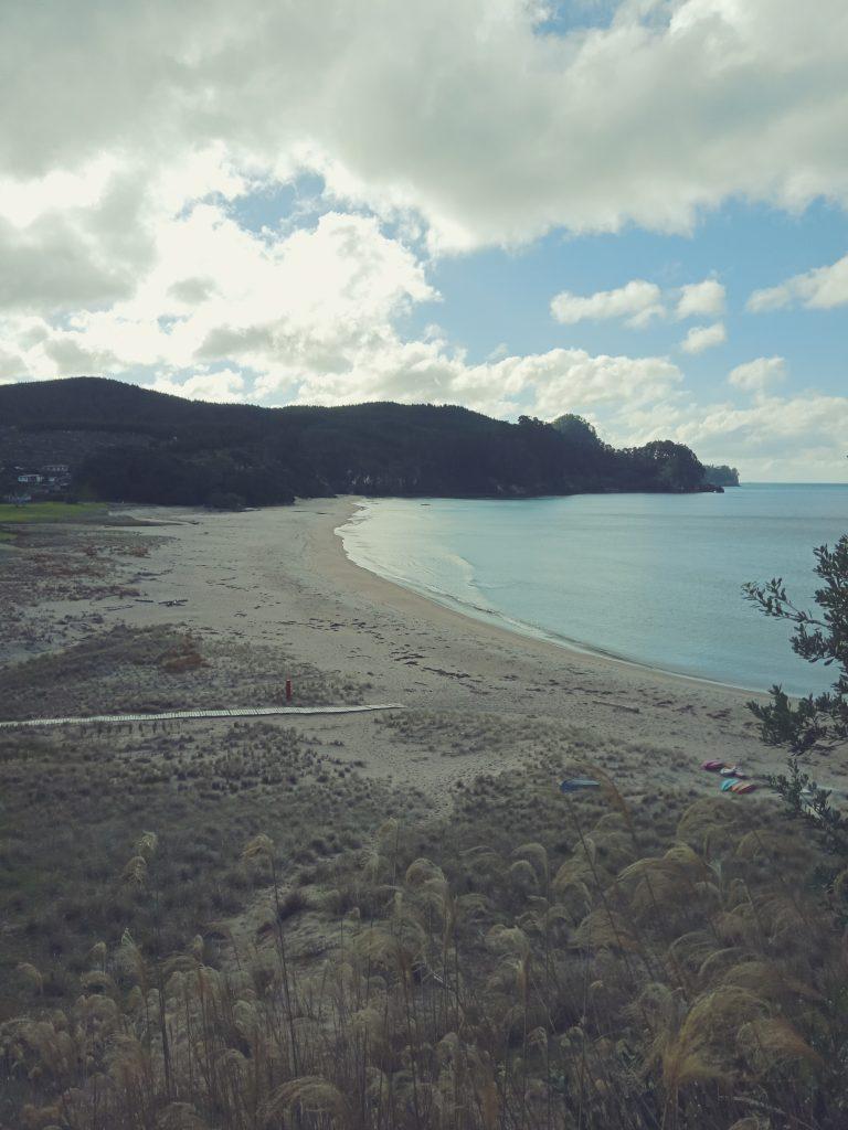
Onemana Beach from the hill track
At the top of the hill on the Onemana Beach Access Road is a road that takes you to the peninsula that separates Onemana from Whangamata. This very rough unsealed road ends at a carpark that overlooks Whangamata and out to sea. There are two short walks from this carpark, one a 15 minute loop track that, although is a nice walk, doesn’t provide any advantage other than one rocky outcrop with a view closer to the one from the carpark, but of no real advantage. The other track takes around 25 minutes down to a secluded bay, but a long up hill climb again.
Whangamata is one of the main towns of Coromandel and although not as “up market” as Pauanui and Whitianga is still a popular holiday destination for many New Zealanders. The beach is awesome and there is a sheltered harbour as well. With many islands close to the shoreline, I would imagine that fishing around them would be pretty productive. Do check the maps as many areas are set aside as marine reserves. There are some great beach walks, amazing children’s playgrounds and bike trails.
Heading south from Whangamata the road continues it’s twisty and hilly journey towards Waihi. The road is sealed and in mostly very good condition, but there are very few areas for passing or to allow slower vehicles to pull over. Although it’s only 29 klm’s from Whangamata to Waihi, allow 40 to 45 mins if towing or in a larger motorhome. For cyclists, be ware that there is literally no side berm and you will get clipped by those drivers too arrogant to slow down for you. Motorcyclists will love the tight twisting turns.
Approximately halfway between Whangamata and Waihi is the seaside village of Whiritoa. This beautiful beach is home to white sands, crashing waves, gorgeous views and a number of holiday homes for those luck enough to afford one here. There is a very small local store selling ice creams and basic food items, a surf club with attached function room which would make an ideal wedding venue as it’s right on the beach with level street access.
Here is a video of the beach.