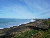
This region covers the lower central and eastern area of the North Island and is a treasure trove of little known hidden gems. The rugged East Coast beaches resemble their West Coast cousins in their beauty. Tall cliffs and swelling, surging seas make for amazing vistas.
The roads into the accessible areas are all pretty good, suitable for all vehicles, but can be steep with tight turns in places. The main beach areas are all sealed roads and there’s normally plenty of parking areas close to the beach. There are commercial camp grounds as well as plenty of responsible (freedom camping) sites. Many areas do not allow dogs as wild life is abundant with seals, penguins, sea birds and in some cases kiwi are nesting. Make sure you check the local regulations for camping.
Look at the local beach signs for safe swimming spots as the seas can be very rough most of the time.
Wairarapa is well known for it’s strong winds and in our own motorbike tours we’ve encountered some very strong side winds that can push you right off the road. At times, in exposed areas large sided trucks, campervans and caravans have found themselves on their side. Check weather reports if you are planning a trip in this region.
So what are some of the highlights?
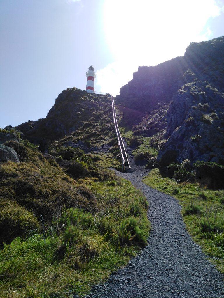
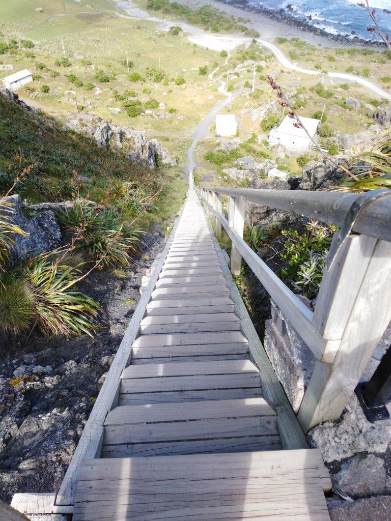
The region is predominantly beef and sheep farms with dairy farms in the flatter areas. Castle Point is one of our favourite places to visit. The light house has formed walkways leading up to it. You can access it easily at low tide and you can clearly see the path from the beach. There is a reasonably sized car park right at the end of the road, but during busy periods parking will be a premium. There a good turning bay which most large rigs will manage, but the free camping allowed in the carpark from 5.00pm to 9.00am won’t accommodate anything over 8 mtrs. The car parks are very tight so slide-outs on your camper/van may not have room. There is a campground back along the beach with amazing views of the beach and lighthouse. There are a number of walking tracks, all well sign posted.
Castle Point is a beautiful and unique location. You can go on a fishing charter on one of the many boats launched via huge trailers into the sometimes story seas, take a walk along the beach or around the lagoon, walk out to the lighthouse and enjoy the sea views and rock formations.
You can stay a few days, a week or so, what ever you like. Like all sea side places, when the weather is fine, warm and still, it’s a great place to be. But when the weather is wet and wild it can be not so nice. There is a local hotel, but no fuel, grocery store, cafe etc.
There are public toilets, no showers apart from the camp ground.
Heading back towards Masterton, the nearest large town, there is a road, all sealed, to another seaside community, Riversdale. I am not aware of any free camping spots here.
In the north eastern seaside region of Wairarapa are some wonderful beach side communities that offer limited accommodation but amazing beaches. One such place we have come to appreciate is Herbertville. It offers fishing, surfing, swimming (although be mindful of strong rips) a seal colony and peace and quiet. Large rolling grassed farming hills backdrop the long sandy beach. It can get quite windy here as it faces out to the Pacific Ocean.
At the time of writing this, there is a local pub and cafe, but this is currently on the market with the owners stating that they will close it down permanently if not sold. (Jan 2019)
You will see locals riding their motorbikes and quad bikes along the beach to their favourite fishing spots. The road in from the north and west are all sealed, but from the coastal route south there are some unsealed sections. For responsible campers there are some lovely seaside gassy areas to parkup for a few days, free of charge. There are public toilets just before the seal ends along Seaview Road that runs parallel to the beach. You can easily access the beach and walk along the smooth sand.
The seal colony is at the far northern area of the beach and is a good hours walk from where the northern access road ends, or of course along the beach itself if you’re super fit.
Heading south from Masterton, through Carterton and Grey Town but before Featherston you will see a sign on the left pointing to Cape Palliser and Lake Ferry. The roads to these two interesting places is very good, suitable for all vehicles.
Cape Palliser. Wow, what a beautiful spot, right at the bottom of the North Island, further south than Wellington. Like most other beaches on the East Coast of Wairarapa and Hawkes Bay the closer you get to the beach, the steeper and more twisting the roads. They are good roads however and there wouldn’t be many vehicles that could not easily navigate them. I’ve included a video of the road coming out as far as the turn off to Lake Ferry. From Statehighway One to this turnoff the roads are mostly flat, wide, well sealed and in good condition.
Cape Palliser is 7 klm’s from Ngawi the main beachside community where there is some water, a small dump station, long-drop toilets. There is a grassy level area right on the beach which has plenty of space most of the year round, but will get full very quickly in the busy summer period December to end of February. There is a donation box, but otherwise free to camp in self contained vehicles only.
The launching and retrieving of the local fishing boat fleet is something you must witness.
Often the question is asked, “what’s the road like going to Cape Palliser/Ngawi?” Well here’s a video of the road as you leave the area back to the main road. Sorry, there’s no stimulating audio, so just mute the volume and put on some easy listening music of your choice.
Here are some photo’s of what you can expect to see at this amazing seaside village.