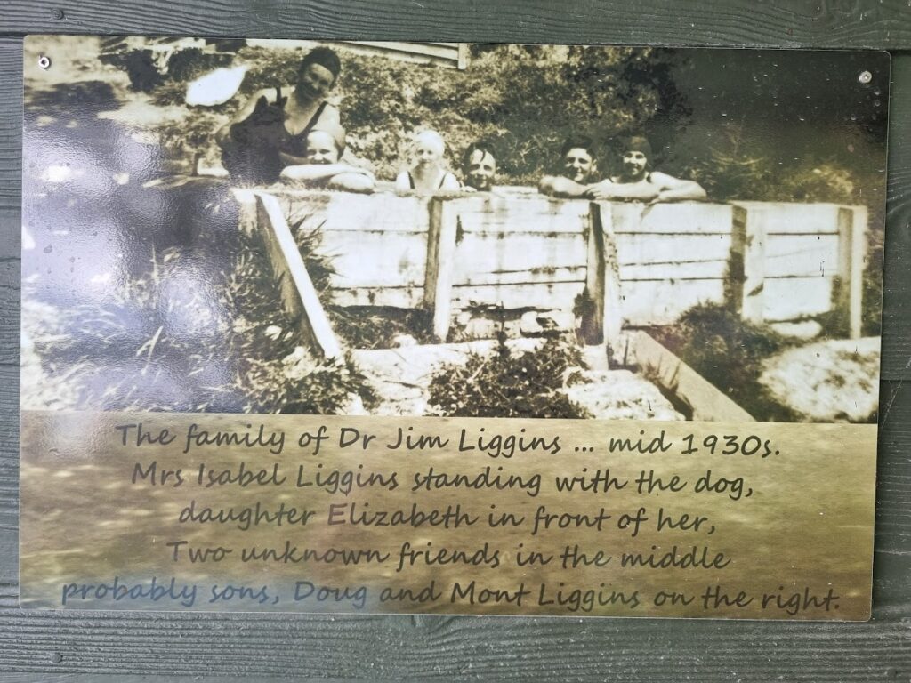
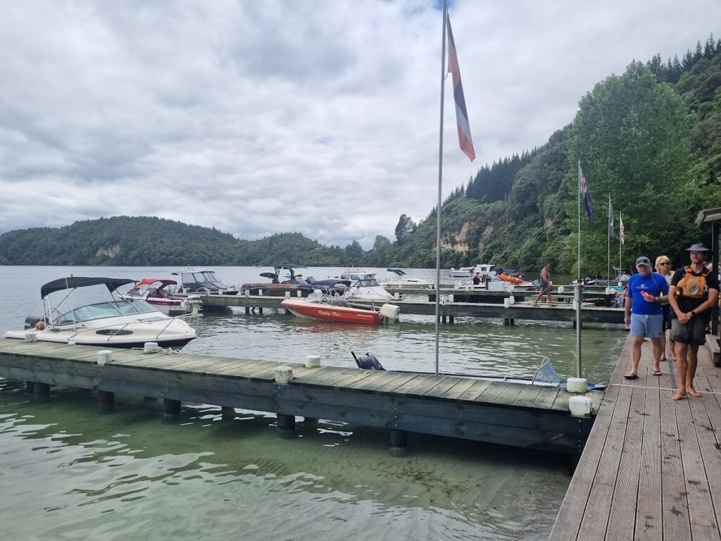
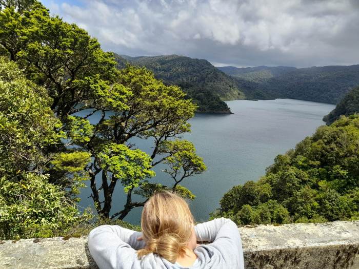
Taupo, right in the centre of the North Island and beside the largest lake in the country. Mighty Lake Taupo is fed from the majestic mountains at the southern end and which can be clearly seen from the northern end on clear days. The lake water is crystal clear and safe for swimming, but not drinking. A favourite spot all year round with locals and international visitors alike.

In the Christmas and New Year period the town gets very busy, swelling with holiday makers bringing their boats and jet ski’s. There are a myriad of activities to have a go at, from costly bungy jumps to walking and cycling or simply swimming in the Lake.
It’s impossible to list every activity on offer so I’ll mention our favourites.
Almost opposite the Mobil Service Station by the intersection where the Napier Road ends at the lake front is a small reserve where just at the waters edge a hot water system warms the water nicely. It’s our favourite swimming location. There’s a small car park on a short access road and just a few meters to the shoreline.
Here’s a list of must see and do activities with links to information web pages.
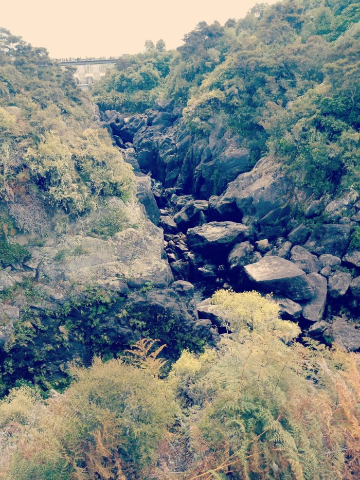
Aratiatia Rapids Part of the hydro system that provides electricity, the dam is opened twice a day and you can watch the water rush through the narrow rock canyon from a number of vantage points. Just 10 minutes outside Taupo towards Rotorua. Check the website for the times during the day the control gates are opened.

Tongariro Cycle Trails A great shorter ride beside the river and state highway 1, Turangi, this can easily be ridden as a loop ride. We started at the northern end over the bridge. This rises steeply, then runs fairly flat. The views of the river are limited until closer to the southern end. Also the first section is through scrub and blackberry until you reach the bush section.
Huka Falls One of New Zealand’s favourite tourist destinations you can watch the Waikato River rush through a very narrow section of rock before tumbling over the falls. A very short, level walk from the car park and across a bridge to a lookout right beside the falls.
Huka Fall Cycle Trail This is not a great ride, it is quite challenging, but worth doing if you’re keen. You can not ride the Huka Falls walking track. From Huka Falls you can bike to Aratitia Rapids.
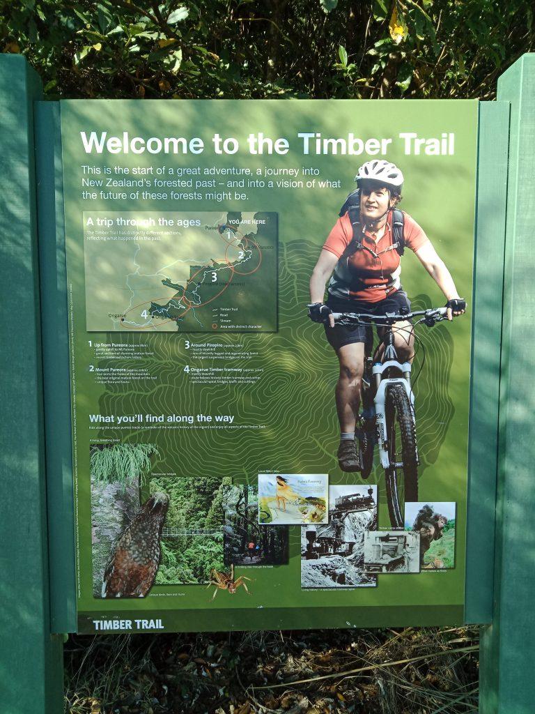
Timber Trail This is one of the great rides of New Zealand. Located in the central North Island this 85 klm trail can be ridden in sections. It winds its way through a variety of bush, exotic trees and open tussock. There are 8 swing bridges that are amazing but not for those scared of heights. The first 13 klms are pretty much uphill, then long sections of downhill with minor uphill parts. We strongly suggest getting a package deal with accommodation and pick up and drop off. There are a number of companies offering these services.
Here are some images taken from our ride where did half the track over Easter (April 2019)
Start of the Track, near Bennydale
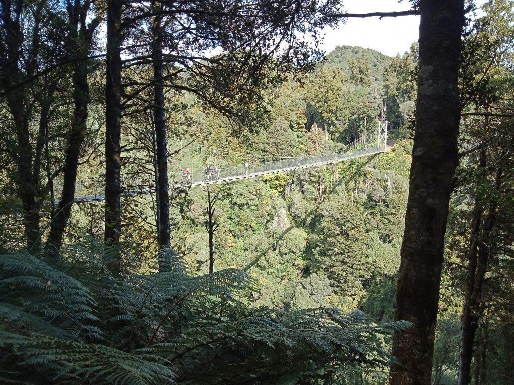
The first of 8 swing bridges that traverse the steep gullies. This view is what you see as you approach the bridge.
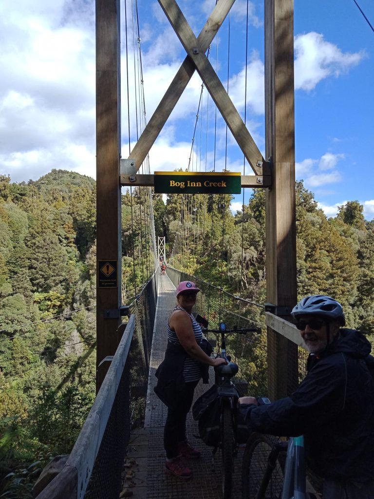
They look quite scary, but are actually very safe with minimal swing motion felt. It is recommended to walk across.
There are a number of trails along the banks of the river, the longest river in the country. We drove from Taupo to Mangakino and freedom camped by the lake, next to the golf course. You must be certified self contained to stay here. The access to the track that runs south as far as Atiamuri.
We rode from Mangakino to Whakamaru. The trail is mostly gently up and down with picturesque views of the river from close up to several meters above. On one side is mainly farm land and the river beside you. The dam at Whakamaru is worth riding over, in-fact you need to access the section of trail from here to Atiamuri.
These small villages offer cafe’s, restaurants, toilets, fuel and some craft shops.
The river at Mangakino is very popular with water skiers and we heard them out enjoying the river from daylight to dusk.
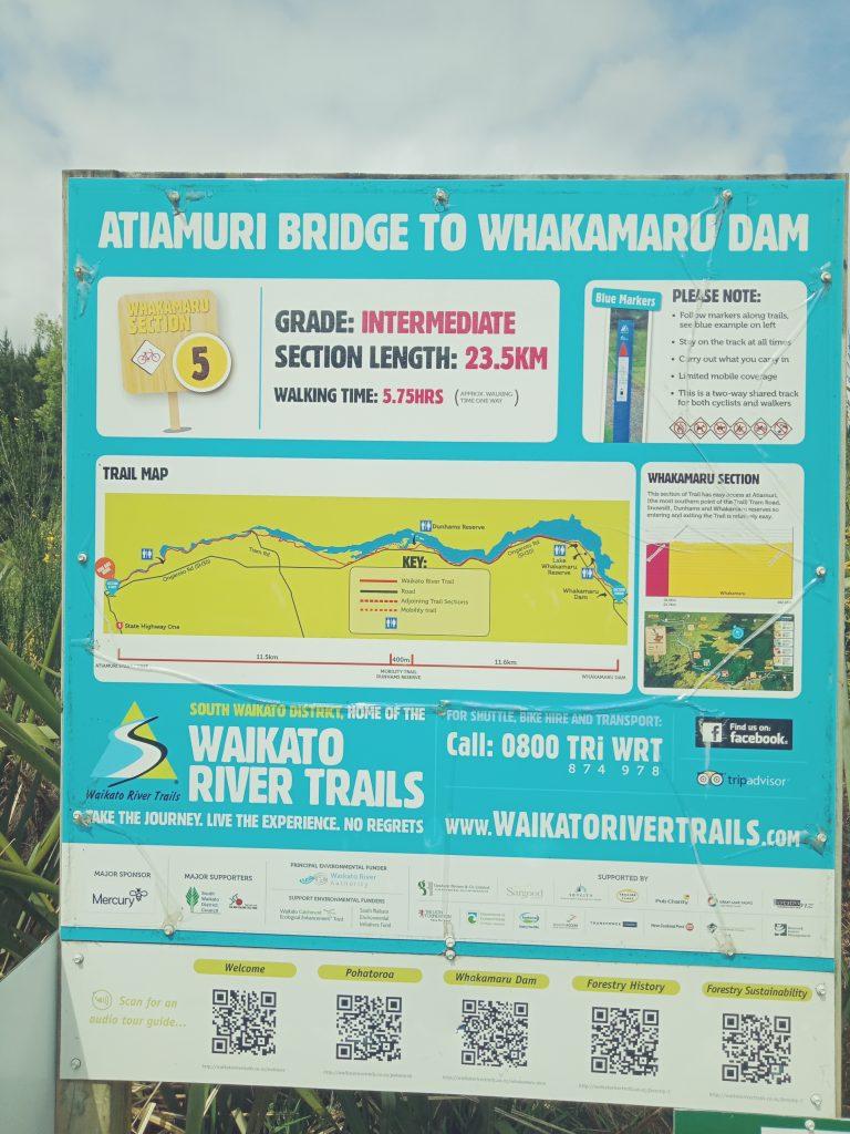
The Waikato River Trails cover a number of sections in it’s 105klm length and unless you have shuttles or groups of friends to transport you from the start/finish back to your vehicle, one way to ride the trails is to cut the sections into “there and back”. We’d done the Mangakino to Whakamaru and back and decided to ride from Atiamuri to Whakamaru section, there and back, some 50klm’s return. However as we slept in at Taupo, we didn’t start the trail until after 1pm and as we love to stop and admire the views, a 15klm section took us over 2 hours, so calculating that at the half way point to Whakamaru we were actually only 25% of the way there and back. We decided to turn around and head back and tackle the other half the next day, starting a bit earlier. This way we will have covered this 23.5klm section.
The ride from Atiamuri can be started in the village down by the boat ramp where there’s a car park or back over the bridge North of the village and first left immediately over the bridge and there’s a car park on the right. Starting from the boat ramp ads 2.6klms one way (5.2Klm return). The trail is really easy, well made and just a few tiny up’s and downs, easily managed by all riders. Just a tip for riding later in the afternoon, myriads of small sand fly or mosquito’s are about and you can easily swallow them which is a bit disgusting. Better to cycle morning to early afternoon. The trail is popular on weekends and public holidays in good weather. This section only has shops at the Whakamaru end. There are a number of clean toilet facilities found along the track and are well marked on the trail maps.
Here are a few photo’s of the first 14klms.

A few klm’s north on the trail, looking back south. The prominent hill in the background you can see is where we started from, actually on the southern side of it.

Any muddy or wet areas have boardwalks provided. This is one of many such sections, all quite short
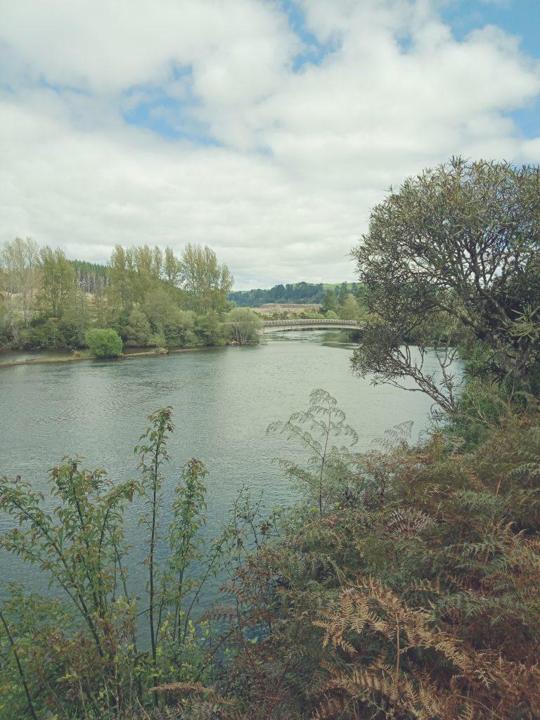
The trail follows close beside the Waikato River
Another section of the Waikato River Trails is the northern most one, some call the start. This is beside Lake Karapiro on Horahora Road. The actual start is beside a bridge near the northern end of the road, but the trail basically runs right beside the road, so most start at Little Waipa Reserve which is also a great place to camp too. I have included this part of the ride in the Taupo section and not Hamilton section as Taupo is a great central location to access these rides.
The reserve has toilets and free hot showers! There are also free gas BBQ’s. The reserve is large and you can camp there for two nights, any longer and a permit is required. The off-road section starts here and heads south to Arapuni which is a power station built into the rock. This ride is awesome, an easy gravel track that follows close by the river. It’s only around 7 klms to the power station. Some of the views are awesome as you will see from the pictures below.
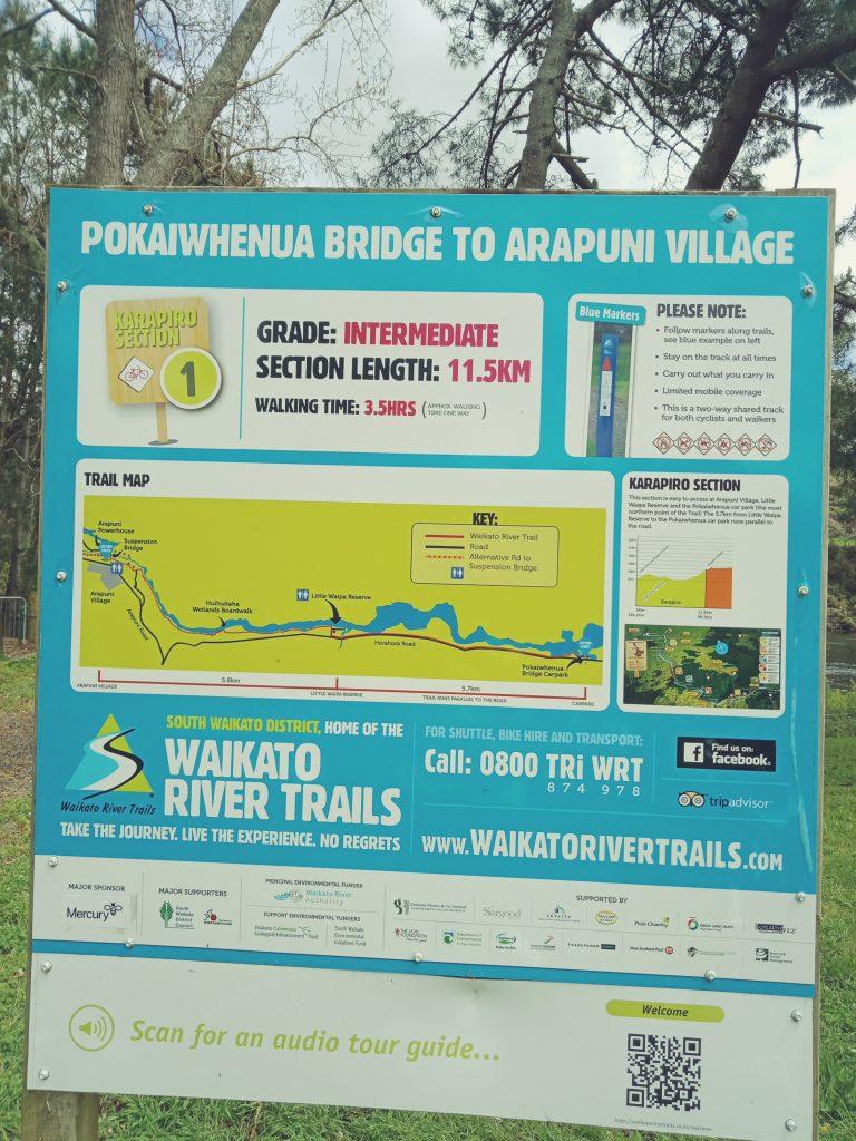
Although this sign says 11.5 klms, at this point it is only 7 klm’s as the start is up the road further and basically follows right beside the road and holds little interest.
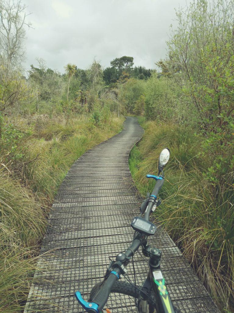
A view on one of the many boardwalks along the trail, this one being 500 mtrs
Video of riding along the 500 mtr board walk
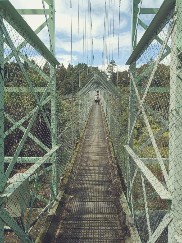
Near the Arapuni Village, there is the 150 mtr swing bridge that connects both sides of the river, mainly the village and the power station itself.
One of the most popular “Great Walks” of New Zealand is “The Tongariro Crossing”.

After crossing the first plateau you start climbing!!
My family and I did this walk at the end of January 2022. This is not a walk for the feint hearted, but quite achievable for most fit healthy people. I hadn’t done an extensive walk like this for decades and had no warm up walks so found the going quite tuff. It is 19.3 klm’s and crosses Mt Tongariro. Most people start at the Ruhapehu end and head towards the Turangi end. There is no vehicle parking there so you need a driver or shuttle to drop off and pick up. The first hour is the easiest and then you reach “The Steps” which take you to the summit of the track with amazing views. Do not get confused when you reach the first steep climb, this is NOT “The Steps”. These take you to a plateau which you walk across before you reach these deadly steps that are quite difficult to conquer. When you reach the summit you will look down at “The Shingle Slide” and some awesome lakes. Take your time going down this very slippery slope as your footing is not secure and it is very steep. Once at the bottom, you walk across another plateau before a short climb that leads past another gorgeous lake and the downhill section which zig zags slowly downwards.
Personally I find the downhill sections the hardest of any walk. This trail has hard plastic pads which seem to jar your every step and with the sun beating down you get very worn out. Finally, you reach the tree line and some shade and the walk becomes more enjoyable amongst the native bush.
This is NOT the base of the Devils Staircase, that’s further on.
There are toilets scattered along the trail. Take plenty of drink and food. They recommend a litre and a half, but I went through over three litres and was still very thirsty at the end. Winter will be different and a lot more dangerous with ice, snow and wind. even in summer a sudden cold snap can occur out of the blue. Always check the weather.
This is a very popular walk and there can be long queues at the steep climbs and descents. Be patient, take your time and breath in the pure air and beauty of this majestic mountain. believe me, all the pain is well worth it.
Rotorua to Lake Waikaremoana
A journey not for the faint hardened, but one of spectacular beauty, is the road from Rotorua to the East Coast. Along the way you will come to an amazing lake frequented by locals and revered by Maori for decades.
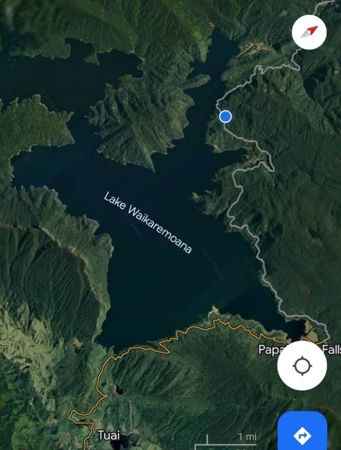
Lake Waikaremoana is a hunters, hikers and trout fishers dream. Located in rugged bush land, it’s not an easy quick drive to reach, but if you don’t mind twisting turns and gravel roads, then this is an adventure for you. This stunning lake has clear clean water, a walking track the circumnavigates the lake and a great campground to stay for a few days to explore the area.
A view of the lake from the road
Some sections have been missed, but you will get a good idea of what the road is like.
Many people ask “is the road suitable for caravans and/or motorhomes. In my opinion, no, not from the Rotorua end. I understand, but don’t know for sure, but the road to the lake campground from Wairoa is sealed, but still steep and twisty. This is a great road for adventure motorcyclists, as for a full on road bike, only for very confident riders, especially when it’s wet.
On the road back to Rotorua from the campground and just before you go over the first bridge, turn right and drive a long a short road to access a quick, easy walk to Papakorito Falls.
Because the roads in the very centre of the North Island are mostly gravel, steep and twisting, you must allow plenty of time and not rush. There is a café at Ruatahuna with toilets, WIFI, fuel and coffee which is a great place to stop. This is run by the local IWI and offers bright modern facilities and you will see plenty of the locals coming and going as it’s quite a journey for them to get to the nearest shops.
Many of the locals living in this area live “off the land”, hunting and growing their own food. Many still have no power and there is no cell phone coverage.
As you drive along it’s very common to see wildlife like horses, cattle and pigs wandering along the road.
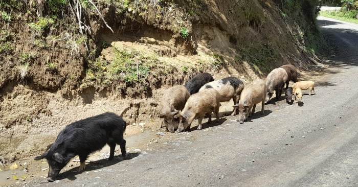
Do not approach them they are wild and may very well attack, especially with young ones around.
Rotorua is literally dozens of lakes of all shapes and sizes and they attract boaties from all over the country. Most of these lakes are crystal clear and safe to swim in, but some are full of lake weed which can wrap around your feet and pull you under, so make sure you take care.
One of the most beautiful lakes is Rotoiti and a very popular spot on this lake is “The Hot Water Pools”. Accessible only by boat or a walking track it is well worth visiting. At the time of writing (January 2023) the pools price is $25 adult and $15 a child.
We have a small “dingy” with a 5 horse power motor and it took us 30 minutes from the boat ramp at Okawa Bay near Mourea.
There are a number of heated pools with varying temperatures, a shop, bbq areas and a jetty that has a slide into the lake.